Category: Workshops
Tools & Apps
| April 13, 2010 | 11:31 am | Tools & Apps | Comments closed

Here’s a running list of tools and apps that might be useful for your projects. If you need further assistance with any of these, just make an appointment with me or an ITF.

*****

TOOLS

How to create animated effects for graphs and charts.

Use Keynote (available on your laptop)
* See Tutorials for further instructions, especially “Using Advanced Bills to Animate Objects On and Off Slides”

How to create animated maps

Use Social Explorer (full features available when you log in at CUNY)
* Use the “Map” tool to create a slideshow by dragging the still image of the map you want to use
* Export as a Powerpoint file

*****

APPS

Dipity

Dipity create a visual timeline like this:

The History of Macaulay Honors College, a timeline created by students of the Class of 2013 at the Spring 2010 Tech Fair

Download Helper

Download Helper is a Firefox extension that allows you to download videos into editable files from various video sites. You can also download multiple images on a page in a single operation.

Flickr Annotations

Flickr offers a quick and easy way to annotate photos, like this

Google Maps

Google Maps is a great way to create and customize maps. Images and video can be embedded in your maps.
View Hunter College in a larger map

See here for more information on creating Google Maps.

Keepvid

Like Download Helper, Keepvid allows you to capture videos from YouTube and other video sites, so you can download it as an MP4, then import it into iMovie and mash away…

Slideshare

Slideshare allows you to share a Keynote or PowerPoint presentation with others, to embed your presentation into your site, to add audio to your presentation, and find presentations in the SlideShare community. Also works with documents and PDF files.

Voicethread

Voicethread allows you to create a conversation around a video, document or photograph.
Creative Commons
| April 13, 2010 | 10:54 am | Creative Commons | Comments closed

An alternative to using copyrighted images, music or video for your projects is to use “copyleft” works, more specifically those licensed under Creative Commons. Creative Commons is a nonprofit organization that creates tools to allow creators of online digital content to control and promote the use of their work. Generally, images or music with a Creative Commons license are available for you to use for free, sometimes with certain guidelines (for example: attribution, no modification allowed, non-commercial use). Of course, you can also designate your creations under the Creative Commons (See the different types of licenses available here).

Below is a list of websites from which you can source for images and music that have a Creative Commons license:

Images

http://search.creativecommons.org/
http://commons.wikimedia.org/wiki/Main_Page

Music

An alternative to using copyrighted music is to use “safe music” that’s been Creative Commons-licensed for remix and reuse. You can find such music here:

http://www.jamendo.com/en/
http://www.musicalley.com/
http://spinxpress.com/getmedia

Fair Use & Recommended Citation Practices
| April 13, 2010 | 10:53 am | Fair Use & Recommended Citation Practices | Comments closed

Fair Use

As you’re working on your various assignments, you may find yourself incorporating materials readily available on the Internet in your own work, whether it be images, music or video. While you are welcome to utilize the resources available on the Internet, it is important that your work adheres to fair use guidelines. Use of copyrighted materials generally falls under fair use if they are used for educational purposes. However, you must provide clear citations of all the sources you include in your work. Just as you would not want others to pass off your work as their own, intentionally or otherwise, you should also observe good citation practices when it comes to incorporating someone else’s work in yours.

*****

Citing Online Images

If you’re using an image that you have not created, it is important that you cite the source appropriately. When you’ve found an image you’d like to use, note down the following information:

Title of image (if any)
Creator of image (if known)
Creation date (if known)
Location of image (if known)
Name of website
Date you accessed the image.
URL

Create a citation, one that adheres to the stipulations of the citation style your professor would like you to follow. The citation should be placed in a visible place. If you have a “References,” “Bibliography,” or “Works Cited” section on your website, be sure to include images you use in the list. Always include the image title and creator next to the image. Where possible, create a link to the website from where the image was obtained. See example below. If you’re using the image in a movie, include a citation as a text caption.

Example:

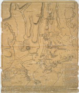
Note that the image is a link to the New York Public Library site from which the map is obtained.

A plan of New York Island, wit... Digital ID: 1261077. New York Public Library

Image title: A plan of New York Island, with part of Long Island, Staten Island & east New Jersey : with a particular description of the engagement on the woody heights of Long Island, between Flatbush and Brooklyn, on the 27th of August 1776 between His Majesty’s forces commanded by General Howe and the Americans under Major General Putnam, shewing also the landing of the British Army on New-York Island, and the taking of the city of New-York &c. on the 15th of September following, with the subsequent disposition of both the armies / engraved & publish’d by … Wm. Faden. (Oct 19, 1776).
Creator: Faden, William, 1750?-1836 — Engraver

*****

Using Music in Web-Published Videos

You may have heard that “Youtube now mutes videos with unauthorized copyrighted music.” Clearly, this will effect your movie editing choices as you decide on what soundtrack you want to accompany your video footage.

You may have also heard that it’s okay to use copyrighted music as long as you limit it to 30 seconds. However, whether it’s a firm okay is subject to debate, as there is no hard and fast 30-second rule. Your best bet is to familiarize yourself with what constitutes fair use and exercise good judgment when incorporating music (or video footage) created by someone else. The Center for Social Media has published a Code for Best Practices in Fair Use for Online Video, a resource I highly recommend you read before making online videos.

As with images, you should also cite the sound recordings that you use. Note down the following information of your sound recording and provide an accompanying citation:

Artist name (Note down composer and performer where relevant)
Song title
Recording manufacturer
Medium (e.g. MP4).

Mini Planning Project
| April 12, 2010 | 8:09 pm | Project Abstract, Workshops | Comments closed

For my planning project i plan to look into the neighborhood known as “The Lower East Side”. The title “Lower East Side” refers to the neighborhood in Manhattan located south of East Houston Street and west of the East River. Generally, it has always been an poor immigrant neighborhood, however, it demographic has undergone a change in the last 30 years or so. Previously, it housed European immigrants (Italians, Poles, Germans, etc.) and is now home to a large hispanic population alongside an “alternative” (new, young, white, hip) culture. It was once home to a plethora of tenement houses and although the people there experienced their fair share of trauma, the neighborhood was theirs and so culturally rich. Despite the maintenance of a blue collar presence in the neighborhood, it is in the process of going through a massive gentrification phase. One of the most historic places in the country  is slowly losing it character to greedy developers. Slowly but surely long time residents are being pushed out.  Just to get slight inkling of what is going on, over 8,000 units of affordable housing have lost there in the last decade and rent costs are rising far faster than average household income. For my project i plan on delving into the major details of the transformation that is occuring there from three prospectives: one of pure fact, one from the the prospective of newcomers, and one from the prospective of long time residents.

Union Square
| April 6, 2010 | 8:48 pm | Project Abstract, Workshops | Comments closed

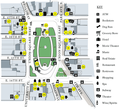
“Union Square” is not just the name of the 3.6 acre park lying between 14th and 17th street. Over the years the name “Union Square” has come to refer to the vibrant and diverse residential and commercial community in which Union Square Park is the heart. The park was opened to the public in 1833, and over the course of more than 170 years, the park, as well as the surrounding area of Union Square, has undergone numerous rennovations, which have successfully improved the physical and social aspects of the area as a whole. The park offers the public a lush, green area to which tourists and locals alike flock, and the more than 150 eating establishments, bars and markets within a two block radius of the park offer a different appeal. The area is supported by both public and private efforts, which are constantly working to maintain the area, as well as to improve, and utimately eliminate the issues that are still faced, such as a lack of arts/entertainment within the park itself and overall pedestrian safety.

Tudor City, NYC
| April 6, 2010 | 12:30 pm | Project Abstract, Workshops | Comments closed

For the Mini Planning Project I will be focusing on Tudor City.  Initially opened in 1927, Tudor City sits nestled away between First and Second Avenues from 44th to 40th Streets.  It is comprised on twelve landmarked buildings with amenities such as private parks, shops and a post office. The neighborhood is very inward oriented and is nearly invisible from its bordering streets.  Architects, Fred French and H. Douglas Ives, specifically designed in this fashion because at Tudor City’s inception slums and slaughterhouses and stockyards surrounded it.  The pair crafted the self-contained neighborhood on a platform to further isolate it from its surroundings.  The land Tudor City was built on was originally a shantytown that housed thousands of squatters until New York City redeveloped the area in the hopes of providing Middle Class Housing.  It is important then to realize that Tudor City not only stands as one of the pioneering urban renewal projects, but more importantly, it is also one of the most successful urban renewal projects of all time.  My project will outline the history of the neighborhood as well as population of Tudor City over the last 83 years.  I aim to illustrate the effectiveness of the redevelopment initiative to provide specifically Middle-Class housing in order to suggest steps to preserve the housing rates in the future.

East New York
| March 23, 2010 | 4:49 pm | Project Abstract, Workshops | Comments closed

Group Members: Danilo Rojas, Richard Lee, Vincent Xue, Joanne Cheung, Patricia Pares, Angela Hum

The Hole

East New York is one of the most underserved neighborhoods in Brooklyn, with half of its 90,000 residents living below the poverty line and receiving public assistance. The neighborhood borders Queens, specifically Ozone Park and Howard Beach, to the east, and it is this boundary on which our plan focuses on. On the outskirts of East New York lies a distinct site with no specified name despite its glaring differences from the surrounding areas. Some residents have come to refer to it as “The Hole”, since the area is 30 feet below grade, a key feature of the area. The site sits at the junction of Conduit Avenue and Linden Boulevard, separating East New York, Brooklyn from Howard Beach and Ozone Park in Queens. The separation is more than physical. A racial and economic divide exists between the two areas as well. The Hole has been neglected for years by the city, with construction projects being started and then being abandoned, leaving vacant lots and abandoned houses scattered throughout the area with an enormous mound of debris overlooking the area. The area has been so neglected that it was once notorious for being a mob dumping ground, and multiple bodies have been found within “The Hole”. With no sidewalks, streetlights, or stoplights, the area looks unlike any other site in Brooklyn, or even NYC, and the problems and neglect become even more apparent when contrasted with the suburban Howard Beach neighborhood lying just a few blocks away.

Planning issues in “The Hole” involve changing the area’s infrastructure to better integrate it with the surrounding communities. Planning needs to take East New York into consideration and determine how to make “The Hole” an integral part of the neighborhood rather than cutting it off. One of the questions that our plan will attempt to answer is how can physical structures and improvements to infrastructure help  “The Hole” to become a site of integration between Howard Beach and East New York rather than being the ugly boundary between the two, almost symbolic of the ugly racial and class divide between the neighborhoods.

Sunnyside, Queens
| March 22, 2010 | 11:33 pm | Project Abstract, Workshops | Comments closed

Group Members: Ignacio Contreras, Mariya Dvoretskaya, Kate Sioson


View Sunnyside in a larger map

Our group will be focusing on the neighborhood of Sunnyside in Queens. Sunnyside has been a vibrant community for a long time, with immigrants coming from all over the world. More specifically though, our group would like to see further development of the Sunnyside yards. The MTA is currently working on their Long Island Railroad East Side Access project, which would run through Sunnyside Yards. We would envision seeing affordable housing, parks and open spaces being built there in order to attract more people to live in the area. We will conduct reseach that will seek to find out the demographics of the area so that we can cater to their needs when we develop the railyard. We seek to improve the quality of life through our planning and development of the neighborhood, so as to create a sunny, pleasant community in which people would desire to live in.

Mini Planning Project: Washington Heights
| March 21, 2010 | 11:43 pm | Project Abstract, Workshops | Comments closed

This planning project is going to be a group project; its members are Noa Krawczyk, Gavin Lue, and Michelle Pelan. The focus will be on Washington Heights (specifically between 160th and 180th streets). There are several issues present in this neighborhood, including crime, unemployment, and education; we have chosen to focus on the poor educational system in the neighborhood. Our project will outline these issues and propose policies and solutions that seek to improve the educational structure. We believe that this will, in turn, alleviate the problems of crime and unemployment because an education opens more opportunities for employment, thereby reducing the need to resort to criminal behavior. Ultimately, a better education improves the quality of life.

Project Idea – Recreating the Domino Sugar Factory of Williamsburg
| March 21, 2010 | 9:37 pm | Project Abstract, Workshops | Comments closed

MHC 250: Mini Planning Project                                                                                                                                                                    Group Members: Ioana Paunescu and Jacquelyn Lekhraj

Recreating the Domino Sugar Factory of Williamsburg

The Domino Sugar refinery helped lead New York sugar-production worldwide. Operating from 1880 to 2004, the “Domino plant employed 4,500 workers, processed 3 million pounds of sugar daily, and was the largest refinery in the world.” Currently the building is out of use. The Domino Sugar Factory remains a center of debate because of plans to preserve the refinery and its surrounding area as a landmark, while others want to create large buildings offering affordable housing. There was a recent plan to reinvent the area of the Domino factory. This plan involved creating a residential complex with four acres of public land and 2,200 apartments. The local Community Board rejected this $1.2 billion plan. City Council member Steve Levin spoke against this project, which would add 6,000 residents to this Williamsburg area, a 25% increase.  The MTA also added that the new development would overcrowd the already densely populated L train line.  It is clear that the Domino Sugar Factory is a reminder of New York City’s industrial and manufacturing past. For that reason, we propose the creation of an arts and cultural center, which would include museums, theaters, open public space, and the Sugar Refinery Building as a landmark/museum.  After further research, we will determine which additions are best suited for this area, particularly keeping in mind the opinions of Williamsburg residents and potential economic growth for this area.

The Historic Domino Sugar Factory