
Though this map cuts off LES at the Manhattan Bridge, it actually extends and includes the Smith Housing Projects between the Manhattan and Brooklyn Bridges
First Developed
The Lower East Side is classified as the area between Bowery, Fulton, and Houston Street. Some people tend to include the East Village as part of the Lower East Side, but this guide will focus on the first interpretation cutting it off at Houston Street.
History of the Habitation of the Lower East Side
The area is one of the oldest of New York City with its earliest inhabitants in the 17th century. Free black farmers settled there as white Dutchmen avoided the area due to its proximity to the Native Americans. The small farms were then merged to form massive holdings. After the American Revolution, much of the Lower East Side became available again after the largest of the holdings was seized from loyalist James De Lancey (Diner). The site then attracted many families of shopkeepers and artisans ranging mostly in the poor to middle class.
In the 1830’s, many of the newly arrived Irish immigrants sought the Lower East Side for its affordability and location. The massive influx of Irish descent immigrants leads to the creation of the first tenements in New York City. Designed to maximize the capacity of people it can hold, tenements often faced unsanitary conditions.
After Irish immigrants migrated to new parts of the City, many German, Jewish immigrants took their place. The Lower East Side thus developed a widely known reputation as an immigrant neighborhood. The new wave of immigrants brought a new title to the area: Klein-Deutschland or Little Germany. Despite the German influence, it would be the Jewish faith that more widely impacted the area. Roughly seventy-five percent of Jews in New York City were situated in the Lower East Side in 1892 (Diner). Working mostly through sewing, the Jewish inhabitants found the housing affordable to their lower-ended wages. The Lower East Side became an epicenter for Jews as traditional food, books, and services were provided. Even after 1910 when many Jews began moving to other neighborhoods, they still returned to buy culturally relevant items.
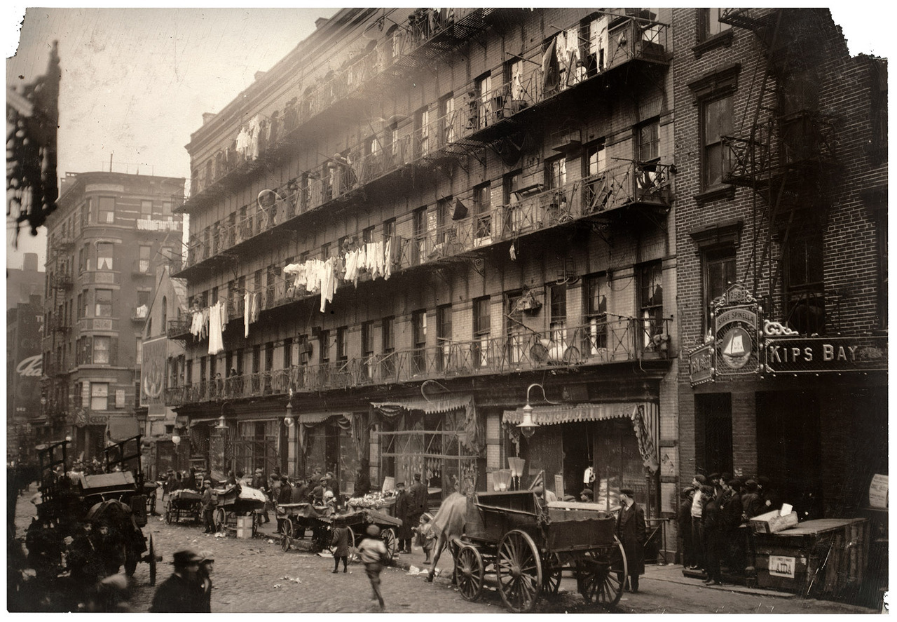
Photo Credit: Row of Tenements, 260 to 268 Elizabeth St., N.Y. Library of Congress Prints and Photographs Division Washington, D.C. 20540 USA Photographer: Lewis Wickes Hine 1912 March LC-DIG-nclc-04208
The Lower East Side continued to house the immigrants of New York City between the 1950’s through the 1980’s. Some ethnic groups included Dominicans, Indians, Koreans, and more. Each new wave of immigrants shared a common theme: live in the low rent area until they can move to better neighborhoods. As each group left, a new one came to take their place. The cycle continued until the 1980’s.
The Lower East Side broke its social stigma associated with immigrants when many young artists moved to the area for the low rent. As galleries, shows, and concerts sprung up, The Lower East Side flourished from the growth of business. Today, the Lower East Side is known for its artistic qualities, but the immigrant influence has not been lost as many cultural sights are still present.

1798 Watercolor of Collect Pond with View of Bayard’s Mount
Notable Changes in Buildings or Streets
One notable change in the layout of the Lower East Side was the dredging of Collect Pond. When the Dutch landed in Manhattan in 1600’s, they gazed upon a pretty five-acre lake they called the Collect. Locals ice-skated there in the winter and it was the main source of freshwater for the colony. By 1700, many breweries and slaughterhouses had sprung up on the banks of the pond and they polluted it with spent grain and rotten pig carcasses. Locals also relieved themselves in the pond. Soon it became infested with mosquitoes and on hot summer days, the stink of sewage was crippling. Malaria and yellow fever were rampant. There were calls to dredge the pond and fill in the land. Thus one of the first notable changes in the streetscape of Lower Manhattan occurred.

Looking down Canal Street at the corner of Centre Street
Canal Street is an east-west street and runs basically the entire width of Manhattan and was so aptly named because it was once a canal for the plague-ridden waters of the Collect to the Hudson.

The Samuel Osgood House at the corner of Pearl and Cherry Streets, residence of George Washington from April 1789 to February 1790
The pond was fully landscaped in 1823 and at this time, immigration to America was a trickle of what it would become. Wealthy individuals from downtown New York moved up to the land reclaimed from the pond and built beautiful rowhouses but soon left when immigrants started pouring into the city, particularly in the Lower East Side. They also fled because their houses were literally sinking into the earth. It turned out that the men who filled in the pond cut corners and did a shoddy job. The houses in this neighborhood began to reek of sewage and bubbles of methane made the ground unstable.

Illustration of the Five Points circa 1827
The neighborhood that developed on top of the pond was called the “Five Points” so called because in the center was the intersection of Orange, Cross, and Anthony Streets, forming an area with five corners. This area would become nationally notorious for crime and disease. The population of the Five Points was predominantly Irish and they were packed in tenements tightly and suffered horrible living conditions. By 1900, the Five Points became a part of New York history.

Manhattan Municipal Building (1914)
The first call to renovate the dreaded Five Points came in 1931 from business owners who operated near the neighborhood. Because of efforts by quality of life reformers, the neighborhood was torn down and in its place the New York Civic Center was built. Including buildings like the NYPD Headquarters, Thurgood Marshall Courthouse, and Columbus Park.

Alfred E. Smith Projects
Another major transformation of the streetscape in the Lower East Side was the creation of the Alfred E. Smith Housing Projects. In the 1950’s there was a movement to change cities for the better and one way to do that was to build tall, affordable housing projects. Prior to the projects, there were vibrant neighborhoods of tenement houses. The area that the Smith houses now inhabit looked very much like the tenement houses of Chinatown or of Soho or of the protected South Street Seaport district. Nearly 22 acres of land were razed for the project and they were built in the “Garden City” style, which supported large, self-contained communities, large green spaces, and entirely cut off from the streetscape outside the community. But this model failed miserable in large part to one design flaw: it separated these communities from the larger street grid. Meaning well but this style of housing may have created havens of lawlessness that are hard to police.
Thank you for this article. I confused on how the participation and pivotal contributions of Puerto Ricans in the lower east side has been omitted from this article. The work they’ve done is embedded in the history and identity of the lower east side.